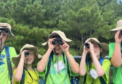
There are several reasons to get out and hit the hiking trails during the winter months. You may be trying to stick to your New Year’s Resolution to lose weight, or you might be looking for scenic vantages without the huge crowds that usually accompany the best viewpoints. No matter your reasons, hiking is not an activity reserved for warm summer months. Travel to a few of these hiking trails to discover the beauty that Virginia has to offer year-round.
Crabtree Falls
Closest Cities: Waynesboro & Lexington
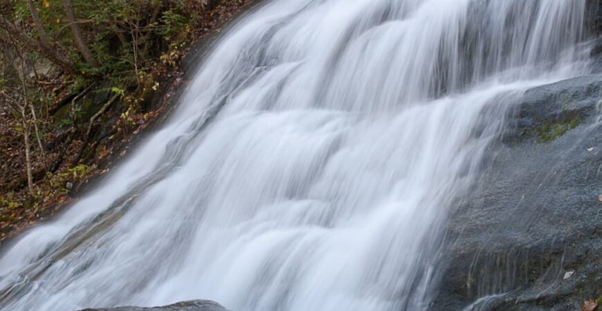
One of the tallest series of waterfalls east of the Mississippi River, Crabtree Falls is a beautiful hike all year round, but summer months find the trails more crowded. Come during the winter for gorgeous, uninterrupted views of the waterfalls. Try nearby Spy Rock or Priest Mountain for an extra hiking challenge.
Bearfence Trail
Closest City: Stanardsville
Off of Skyline Drive, Bearfence Trail is about a mile long ending in spectacular 360-degree views. Take the Bearfence Viewpoint route to avoid the rock scramble. Check the Blue Ridge Parkway and Skyline Drive websites before arriving, as closures occur periodically during winter months.
Cascades National Recreation Trail
Closest City: Blacksburg
The four mile hike on Cascades National Recreation Trail is achievable for even beginner hikers, and the 66-foot waterfall (which can even freeze during the coldest parts of winter!) at the end of the trail make it worth the distance.
Beach and Bay Trail Loop
Closest Cities: Woodbridge & Arlington
Beach and Bay Trail Loop in Mason Neck State Park is a 2.3 mile circuit that is good for all hiking skill levels, with the trail running along the beach showcasing the coastal scenery, even in winter.
Big Schloss
Closest Cities: Luray & Strasburg
Big Schloss is located along the Virginia/West Virginia line in the George Washington National Forest. One of the longer hikes recommended for winter, this is the 4.4 mile sister hike to Tibbet Knob, but the summit provides wonderful views of the surrounding valleys.
Peaks of Otter
Closest Cities: Roanoke & Lynchburg
Made up of Flat Top, Shark Top, & Harkening Hill, the Peaks of Otter Trail system has six trails total. Sharp Top and Flat Top are the hardest, but have the best views at the summit with 360-degree views.
Dark Hollow Falls
Closest City: Luray
Another popular hike in Shenandoah National Park, Dark Hollow Falls typically is fairly crowded in the summer. Visiting during winter months allows you to see the 70-foot cascading waterfall at your own pace without the larger groups of people. In the coldest months, the waterfall has been known to freeze, creating a stunning winter scene.
Brown Pelican Trail
Closest Cities: Virginia Beach & Cape Charles
Located in Kiptopeke State Park on the Eastern Shore of Virginia, Brown Pelican Trail offers amazing views of the Chesapeake Bay and the eerie concrete ships that were sunk over 65 years ago to protect the shoreline.
Roaring Run Hoop Hole Trail
Closest City: Roanoke
In Jefferson National Forest, the Roaring Run Hoop Hole Trail is a 1.2 mile hike near Eagle Rock. The trail features a waterfall and is great for all hiking skill levels. Avoid the upper loop trail, as it is more advanced and much longer.
Tobacco Heritage Trail
Closest Cities: South Hill & Lawrenceville
For those looking for a flat, easy hike, the Tobacco Heritage Trail runs more than 17 miles with several smaller segments allowing you to enjoy the surrounding landscapes and a scenic 300-foot bridge over the Meherrin River.
Stony Man Trail
Closest City: Luray
At the end of the 1.4 miles, Stony Man Trail opens to a gorgeous view of Shenandoah Valley, Luray, Massanutten, and the Allegheny Mountains on a clear day. This beginner’s trail isn’t too steep, but if you’re looking for more of a challenge, try Try Little Stony Man Loop for a 3.4 mile moderately difficult trail.
Lover’s Leap Trail
Closest City: Bristol
For a shorter hiking option, head out to Lover’s Leap Trail, a 0.4 mile hike within Natural Tunnel State Park with moderate difficulty. Afterwards, try the Tunnel Hill Trail, and if you’re lucky, you may get to see a train go through the historic tunnel.
Turkey Neck Trail
Closest City: Fredericksburg
Turkey Neck Trail is a 2.5 mile circuit in Westmoreland State Park that is accessible year round. Right near the Potomac River on the Maryland/Virginia border, the trail ends at the cliffs and beach with fantastic views of the waterfront.
Belle Isle Trails
Closest City: Richmond
The trails of Belle Isle in Richmond wind beside the James River, providing an easy hiking option within a populated urban center. The trail encircles the 54-acre island and is accessible by a pedestrian footbridge that runs under the Lee Bridge. Warm up afterwards with a visit to some of the nearby breweries.
House Mountain Hike
Closest City: Lexington
House Mountain Hike is actually two trails, consisting of Big House and Little House trail. Big House Mountain is shorter, a 1.7 mile moderate hike that can be more difficult in inclement weather, while Little House Mountain is 2.6 miles and moderate. Both hikes offer beautiful views from the summits.
Check out the following trail options if you’re interested in longer, more advanced winter hikes:
- Overall Run Falls Hike–5.1 miles
- Mount Rogers Trail–10.8 miles
- Tinker Cliffs–7.3 miles
Written by Patricia Keppel for Virginia is for Lovers and legally licensed through the Matcha publisher network. Please direct all licensing questions to legal@getmatcha.com.